TERRA INCOGNITA
TERRA INCOGNITA
10 minute HD video
Maps have multiple meanings. For me, being born in one country and migrating to another as an adult, familiar road altases reveal geographical and historical differences between my native country and my adopted one. Maps also show how the land has been transformed by layers of human activity.
Maps are representations of human connectivity that document the way transport networks, settlements and industrial complexes interact with and drastically affect the natural environment. Mapmaking has also been used as a form of conquest, usually preceding the extraction of resources, or the creation of new lands, borders and boundaries. The term "terra incognita" was used by European explorers to define lands that they had not mapped or documented, and were yet to be conquered.
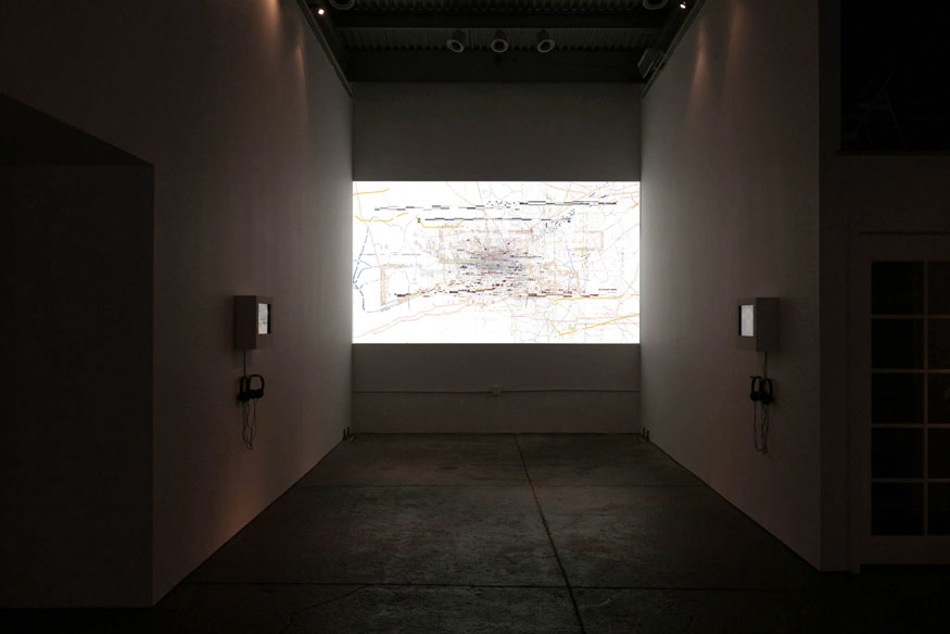 Terra Incognita, 2013, Rachel Clarke, installated at Aggegate Space in Oakland for the exhibition "Full Frame"
While maps represent a stable, topographically accurate, yet symbolic representation of the world as we have defined it, In Terra Incognita the stable structure of the map is deconstructed, fragments are extracted and placed in unfamiliar juxtapositions. This turns what is known into something unknown. Detached from their usual context, the still recognizable fragments form into new visual topologies: the imagery suggests landscapes, but also a cityscape at night, or computer circuits, or constellations, etc. By turning the road altas into a terra incognita, I'm suggesting that the systems used to define how we understand our reality, and how it is controlled, are ultimately an abstraction.
Terra Incognita has been shown at Lamar Dodd School of Art / University of Georgia, Aggregate Sppace in Oakland, CA, WORK:Detroit, MI, at the California State University, Sacramento Faculty Show, and at the ARS ELECTRONICA festival in Linz, Austria.